 |
||||
 |
 |
|||
 |
||||
| |
 |
| |
| |
| |
| |
 |
| |
| |
| |
| |
| |
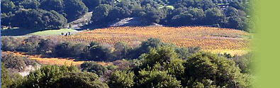
NOTE: Some of these files are large and may take some time to open. Recorded Plats/Parcel Maps The following diagrams are copies of the developer’s original recorded plats for the George Ranch subdivision. Since they were filed, there have been a number of lot line adjustments, changes to the location and size of building envelopes and similar changes. Moreover, with ACC approval, some structures have been constructed outside the designated building envelopes and some leach fields have been moved to locations other than those shown on the plats. Thus, these diagrams are a useful, but not perfect, reference source for information about individual lots, easements, building envelopes and similar information. They should not be relied upon as definitive.
|
||||||||||||||
HOME • ABOUT GEORGE RANCH • EVENTS • CALENDAR • RANCH JOURNAL • GOVERNANCE ©2006-2011 The George Ranch |